
Hedonist Hike 2000 and Volunteer Work Party
Gazos Mountain Camp, San Mateo Co. October 7-8 2000
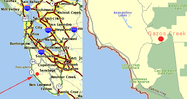
Where is this place?
Gazos Mountain Camp is located at the end of the paved portion of
Gazos Creek Road, off Highway 1 in southern San Mateo County.
It is almost
exactly between Half Moon Bay and Santa Cruz.
Please click on the links for pictures of the route.
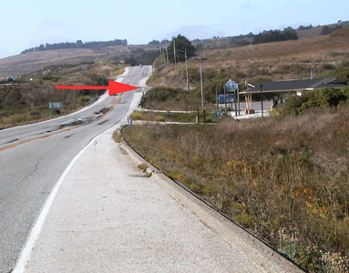
Travelling south, Gazos Creek Road is about 50 yards past the beach
entrance, on the left.
Travelling north, Gazos Creek Road is about 50 yards past the gas station,
on the right.
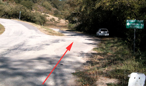
Gazos Creek Road to the camp is about 5 miles. At about 3 miles
there
is a triangle split, and Cloverdale Rd. joins from the north. Stay to the
right, and continue
for less than 2 miles. The entrance to the camp
will be on the left.
Continue on the paved road about 1/4 mile into the camp.
From SF/Marin Co - Take Hwy 280 south to Hwy 92. Take Hwy 92 west
to Half Moon Bay and Hwy 1. Turn left on Hwy 1 south for about 25
miles to Gazos Creek State Beach. Turn left on Gazos Creek Road.
From East/North Bay - Take I-80/880 south to Hwy 92 west (San Mateo Bridge).
Take Hwy 92 west to Half Moon Bay and Hwy 1. Turn left on Hwy 1 south
for about 25
miles to Gazos Creek State Beach. Turn left on Gazos Creek Road.
From Peninsula - Use Hwy 92 directions above.
From South Bay - Take Hwy 280 north/south or 85 south to Hwy 17.
Take Hwy 17 south to Santa Cruz and turn right on Mission St. / Cabrillo Hwy.
This turns into Hwy 1 north. Take Hwy 1 north for about 25 miles to Gazos
Creek State Beach. Turn right on Gazos Creek Road.